Drone photography is a big change from the old ways of doing surveys and making maps. It gives a cheaper, faster, and more correct option to traditional methods. Drones can take pictures in high detail from above to make 3D models or maps with great precision. This makes them very useful for people who work in land surveying, map making , urban planning as well as those involved in construction needing exact geospatial data for different tasks they do.
High-Resolution Imagery for Detailed Mapping
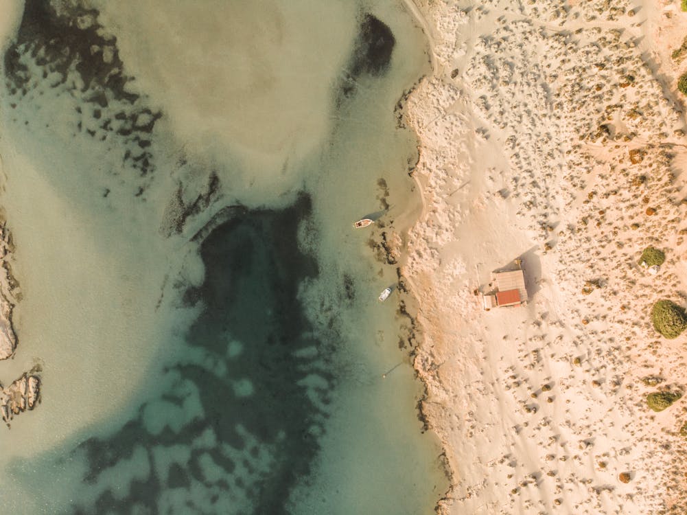
The first benefit of drone photography for surveying and mapping is that it can take high-resolution images from a bird’s-eye viewpoint. Drones, having good cameras and GPS technology, are able to capture detailed images with spatial precision (mapping accuracy). This feature helps in making precise maps or topographic surveys as well as orthomosaics which show how the land appears from above. Such level of detail assists professionals to study features on the ground like hillsides or buildings accurately; they also gain better insight into patterns related to land usage along with infrastructure assets at finer levels of granularity.
Efficient Data Collection and Processing
When it comes to surveying and mapping, a drone photographer makes the gathering of data and subsequent processing a faster process. This is much quicker compared to the old methods, saving both time and resources. Using drones helps in obtaining aerial images of big areas or difficult-to-reach terrain that could be dangerous for ground-based equipment or workers. The photos taken by drones are later processed with photogrammetry software to generate 3D models, point clouds as well as digital elevation models which assist considerably for planning, design and analysis tasks.
Enhanced Safety and Accessibility
For surveying and mapping uses, drones provide greater safety and ease especially in places far away or risky. If companies use drones instead of sending surveyors to hard-to-reach or dangerous areas, it lowers the danger for workers and equipment but still allows them to get precise data that is dependable. Moreover, drones can go into spots not easy or possible to reach with usual survey methods like steep slopes, thick plants and water bodies. This makes them perfect for capturing complete aerial surveys along with mapping details.
Environmental Monitoring and Conservation
For monitoring the environment and preserving it, drone photography is very beneficial. It gives important understanding about ecosystem well-being, mapping where habitats are located, and how land use changes. Drones can take pictures from above of delicate habitats, animal groups living there as well as natural resources. This helps those who study and protect nature to understand effects on the environment, observe alterations over a period of time and create plans for safeguarding biodiversity while recovering habitat too. Also, they can survey disaster-hit or human-involved places; this assists in responding to emergencies quickly and making good decisions about managing the environment.
To finish, drone photography changed how we do surveying and mapping by providing unmatched accuracy, efficiency and availability for businesses and experts in different areas. From taking pictures in top quality for detailed mapping and analysis to making things safer while also easier to reach in far-off or dangerous places, drones have become very important tools for collecting geospatial data that can be used to take action. As technology keeps progressing, the uses of drone photography in surveying, mapping and monitoring environments will keep growing more diverse. This provides fresh chances for innovation and progress within these sectors. Be it engineering and construction works, environmental efforts or emergency responses, drone photography gives a flexible yet low-cost method to collect precise geospatial data needed in business for taking wise decisions and making strategic plans.
